2015 Minnesota State Rail Plan
Re: 2015 Minnesota State Rail Plan
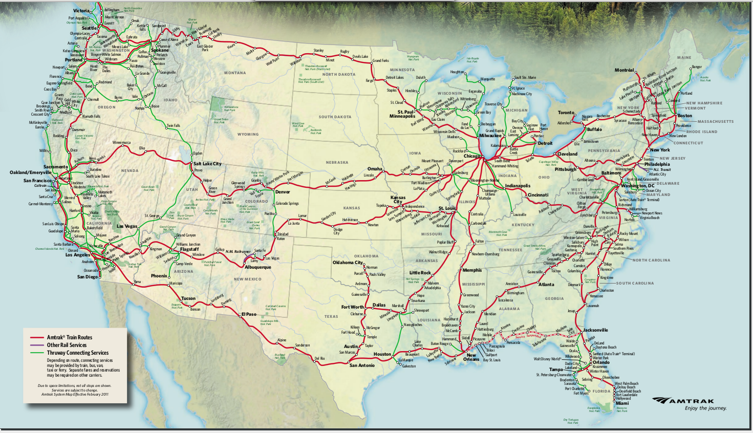
So, it specifies that if everything goes as planned (big if, of course), Target Field Station would need 8 tracks by 2035. Do they have any plan for how that would be accomplished? Was Target Field built to allow more tracks to be dug underneath it?
Joey Senkyr
[email protected]
[email protected]
-
mattaudio
- Stone Arch Bridge
- Posts: 7759
- Joined: June 19th, 2012, 2:04 pm
- Location: NORI: NOrth of RIchfield
Re: 2015 Minnesota State Rail Plan
^This is why the Dock Street Apartments should have never been built the way they were.
-
twincitizen
- Moderator
- Posts: 6380
- Joined: May 31st, 2012, 7:27 pm
- Location: Standish-Ericsson
Re: 2015 Minnesota State Rail Plan
We've torn down plenty of apartment buildings that are 50+ years old. No reason we can't do the same for Dock Street Flats when that day comes.
Re: 2015 Minnesota State Rail Plan
There was a move last week that went up just beyond 185th street on the MN&S line, though it looks like it stopped short of the crossing under I-35 -- the eight miles of track between I-35 and the Minnesota River are in the worst condition.
I'm surprised they only had figures for adding CTC signaling to the line, but don't mention any rehab costs. I'm not sure how much that would run, but it shouldn't be all that bad. Some of the existing rail can probably be reused, though It's hard to say how much it has deteriorated at this point. I presume it's old 39-foot sections of rail bolted together -- there have been "cut-and-slide" projects that chop off the ends of old rail (where there are bolt holes or other damage) and weld them together into CWR for $150,000 per mile or less, though I think that's been on railbeds that had still been decently maintained. This would require all new ballast and other work, but I wouldn't be surprised if it could be done for $200k to $500k per mile.
I think we'd just have to live with the fact that trains wouldn't be going 79 mph through there. Maybe a tilting train like a Talgo could shave off some time.
The bridge is probably a bigger concern than the tracks, though I think there could be just as big of problems with bridges on other available routes toward SPUD.
My favored route for getting to SPUD from Northfield would be to use the tracks that head north from Rosemount along the MN-3 / MN-149 / MN-55 corridor to Eagan/Mendota Heights, since that looks like a much better corridor for commuter service down the line, but a few miles of track have been entirely ripped out there. Replacing those would probably run more than $1 million per mile even though there aren't huge obstructions in the way (the biggest problem being the bike trail that was built along it).
The existing Spine Line route does have the advantage of having a small number of grade crossings to deal with, but that's counterbalanced a lot by the presence of multiple rail yards, which can be pretty expensive to deal with. This document includes a scenario where upgrades are done to UP's yard area southeast of Saint Paul -- just dealing with passenger trains passing by on the CP/BNSF corridor on the north side and nothing really going through UP's tracks, they estimated a cost of $50 million for upgrades to ensure capacity for freight (you can probably get a decent bridge for that price).
Frankly, I think the disused nature of the MN&S line is an opportunity -- less freight interference to begin with, and it gets people directly to the center of activity in the Twin Cities. But really, I'd say that the three routes should all be evaluated in pretty good detail so we can make an informed decision based on the potential ridership, travel time, and cost for each of them.
As for tracks for Target Field, I've heard that there's virtually no way to add more tracks beneath the stadium (which, given the national rate of turnover for sports venues, might disappear sooner than Dock Street Flats). There's a decent amount of room to add stub tracks on the southeast side of the stadium in the current staff parking lots, though -- It's currently owned by the Minnesota Ballpark Authority, but it's a good idea to watch out for any rumblings of developing that area anyway.
Mike Hicks
https://hizeph400.blogspot.com/
https://hizeph400.blogspot.com/
Re: 2015 Minnesota State Rail Plan
The new T3 project will be doubling down on this problem, by the way.As for tracks for Target Field, I've heard that there's virtually no way to add more tracks beneath the stadium (which, given the national rate of turnover for sports venues, might disappear sooner than Dock Street Flats). There's a decent amount of room to add stub tracks on the southeast side of the stadium in the current staff parking lots, though -- It's currently owned by the Minnesota Ballpark Authority, but it's a good idea to watch out for any rumblings of developing that area anyway.
But didn't they sort all of this out during the approvals for Dock Street Flats? I don't recall exactly what the compromise was, but it seemed like people in the know felt like they had it figured out.
Re: 2015 Minnesota State Rail Plan
The plan that they worked out would have four tracks on the northeast side of Target Field, accomplished in part by narrowing the existing Northstar platform and adding a second one south of it. I've never seen proper designs, though -- the bike path has always been a sticking point in my mind, so I'm worried they'd have sharp 90-degree turns on it like the annoying section along the edge of the Federal Reserve Bank property at West River Road.
Mike Hicks
https://hizeph400.blogspot.com/
https://hizeph400.blogspot.com/
-
Ottergoose

- Metrodome
- Posts: 72
- Joined: October 11th, 2012, 3:54 pm
- Location: Burnsville, MN
- Contact:
Re: 2015 Minnesota State Rail Plan
Some very good points by Mike, although I think he's much underestimating the amount of cost/effort it would take to get the PGR/TCWR/CP alignment via Savage up to snuff; even if the track was in better shape, it's still a very meandering/curvy route - I'm clueless with regards to how that curvature is quantified and how it would restrict potential speed (would love an engineering perspective), but, from the folks in the know who've I've talked to, that's the big concern.
Using the alignment into SPUD by upgrading and re-inserting the old Milwaukee track to connect SPUD to Rosemount via Eagan is interesting, although I suspect some of the engineering issues would come into play again.
You have to keep in mind that the freight railroads that have relegated some of the lines in question to spurs, branchlines, or quasi-abandonment, is that they were inferior from a network and engineering perspective - the same characteristics that are good for freight are good for running fast passenger trains. Yes, ridership is important, but if the trains can't exceed the speed of automobiles over these distances on account of the alignment, it's a moot point.
Full disclosure: I'm just a geek who likes trains, I have no background in engineering, all I can do is parrot what I've heard from others who do.
Re: 2015 Minnesota State Rail Plan
Yeah, I'm in that category too. I'd like to find a tool that can calculate curvature -- or maybe something that goes the extra step and even gives a speed estimate. Looking back, that's one reason why I'd been spending a lot of time updating OpenStreetMap -- someone with good GIS skills should find the rail network in most of Minnesota to be drawn well enough to estimate speeds and fairly quickly get an idea of the number of sidings, grade crossings, and other features like bridges.
Mike Hicks
https://hizeph400.blogspot.com/
https://hizeph400.blogspot.com/
Re: 2015 Minnesota State Rail Plan
Regarding the Progressive Rail line from Rosemount to Mendota, I've envisioned using that for the ZipRail line to Rochester, though I might reevaluate that.
Regarding a regional line serving Northfield and points south, I agree with bringing it into SPUD, but the line I envisioned uses the river bridge underneath the Robert St Bridge to connect directly to Union Pacific's Albert Lea Subdivision.
Regarding a regional line serving Northfield and points south, I agree with bringing it into SPUD, but the line I envisioned uses the river bridge underneath the Robert St Bridge to connect directly to Union Pacific's Albert Lea Subdivision.
-
mattaudio
- Stone Arch Bridge
- Posts: 7759
- Joined: June 19th, 2012, 2:04 pm
- Location: NORI: NOrth of RIchfield
Re: 2015 Minnesota State Rail Plan
Yes, that's how it should start. But, if we end up building ZipRail and there continues to be pressure from the freight side of things for the UP line, it would eventually be worthwhile to build a cutoff from Northfield to ZipRail via the CGW/PGR line to Randolph (and then north on the old CGW grade to Hampton, if ZipRail chooses the 52 alignment). This would allow extremely fast running of train service between SPUD and points south - Des Moines? Kansas City?
-
DanPatchToget
- Wells Fargo Center
- Posts: 1658
- Joined: March 30th, 2016, 1:26 pm
Re: 2015 Minnesota State Rail Plan
I've tried contacting MnDOT about what exactly they would plan with the Dan Patch Corridor but no luck. From a Star Tribune article I read awhile ago the plan is for passenger trains going non-stop between Minneapolis and Northfield, and if that is the plan, that is completely idiotic and none of the suburbs along the route would agree to that plan. The Dan Patch Corridor should be used for it what it was originally intended for; interurban trains. DMUs or EMUs serving suburban stops with a maximum speed of 55 mph. in the suburban areas and then 79 mph. between Lakeville and Northfield. UP's Spine Line is built for intercity trains going to Des Moines and further south, but could also have regional trains serving stops in Mendota Heights, Eagan, Rosemount, and Farmington.
-
SamHartmen
Re: 2015 Minnesota State Rail Plan
Have you tried contacting Amtrak?
I think a Minneapolis/St. Paul - Des Moines - Kansas City with stops along several other smaller towns would be a good idea. You seem to know a lot about the existing train tracks. If you took the time to try to select a potential route I would love to hear more about it! I might even look into doing it myself this summer. I know Northfield recently been working on their train depot, plus other communities may also be acceptable to the idea. Not sure if anybody at Amtrak would take the time to read it but if it's a budget line (meaning it's cheap enough) maybe Amtrak or another investor might look into it further?
Plus it would enhance existing Amtrak routes by allowing people from Twin Cities to travel to Omaha, Des Moines, Kansas City, and maybe even a bit faster to St. Louis. It's no HSR, but you gotta start somewhere.
Re: 2015 Minnesota State Rail Plan
Amtrak wouldn't have anything to do with regional rail (i.e. the Dan Patch corridor), so contact them would be useless.
MnDOT may not have much, if anything, because 2002 legislation specifically prohibited future planning along the Dan Patch corridor. That legislation prohibits MnDOT, the Metropolitan Council, and the regional rail authorities from spending any money on planning or building commuter rail along the Dan Patch line. However, recent "workarounds" have looked at intercity rail. Such intercity rail, to avoid the appearance of being commuter rail, would have to have few, if any, stops between Northfield and Minneapolis.
MnDOT may not have much, if anything, because 2002 legislation specifically prohibited future planning along the Dan Patch corridor. That legislation prohibits MnDOT, the Metropolitan Council, and the regional rail authorities from spending any money on planning or building commuter rail along the Dan Patch line. However, recent "workarounds" have looked at intercity rail. Such intercity rail, to avoid the appearance of being commuter rail, would have to have few, if any, stops between Northfield and Minneapolis.
-
DanPatchToget
- Wells Fargo Center
- Posts: 1658
- Joined: March 30th, 2016, 1:26 pm
Re: 2015 Minnesota State Rail Plan
Or call it regional rail or an interurban line so then you can have more stops. At least for Edina that is the only way they will agree to this plan. Or the only two communities that still support the legislative ban (St. Louis Park and Lakeville) can get over their NIMBYism and just see what a new study concludes.Amtrak wouldn't have anything to do with regional rail (i.e. the Dan Patch corridor), so contact them would be useless.
MnDOT may not have much, if anything, because 2002 legislation specifically prohibited future planning along the Dan Patch corridor. That legislation prohibits MnDOT, the Metropolitan Council, and the regional rail authorities from spending any money on planning or building commuter rail along the Dan Patch line. However, recent "workarounds" have looked at intercity rail. Such intercity rail, to avoid the appearance of being commuter rail, would have to have few, if any, stops between Northfield and Minneapolis.
Re: 2015 Minnesota State Rail Plan
Only going to Northfield (which is 43-44 miles -- only 4-5 miles longer than Northstar) wouldn't be interesting to Amtrak, but they'd want to operate a line going further. I heard that they've wanted to be the operator of the Northern Lights Express to Duluth (~150 miles), so they'd definitely want to operate a line between Minnesota and Iowa.
Of course, one of the great faults with Amtrak is that they are not set up to do much rail planning on their own. They squandered 2.5 years of time on the utterly straightforward good idea of a second daily train to Chicago from the Twin Cities.
Of course, one of the great faults with Amtrak is that they are not set up to do much rail planning on their own. They squandered 2.5 years of time on the utterly straightforward good idea of a second daily train to Chicago from the Twin Cities.
Mike Hicks
https://hizeph400.blogspot.com/
https://hizeph400.blogspot.com/
-
SamHartmen
Re: 2015 Minnesota State Rail Plan
...I never suggested Amtrak would be interested in a line from Northfield to Minneapolis. I suggested a line from Minneapolis to Kansas City. If you guys can't be bothered to actually read my comments then I clearly am just wasting my time here.
Re: 2015 Minnesota State Rail Plan
You asked Dan if he'd contacted Amtrak, when Dan was specifically talking at the time of trains between Northfield and Minneapolis. His comment about UP's Spine Line was an add-on, but the main point of the discussion was the Dan Patch line.
-
DanPatchToget
- Wells Fargo Center
- Posts: 1658
- Joined: March 30th, 2016, 1:26 pm
Re: 2015 Minnesota State Rail Plan
To Kansas City is what the Spine Line is for. If this intercity service were to serve Minneapolis it should be routed through SPUD. Keep in mind that this could someday be a true high speed rail corridor, and the Dan Patch Corridor is not the place for high speed trains....I never suggested Amtrak would be interested in a line from Northfield to Minneapolis. I suggested a line from Minneapolis to Kansas City. If you guys can't be bothered to actually read my comments then I clearly am just wasting my time here.
-
mattaudio
- Stone Arch Bridge
- Posts: 7759
- Joined: June 19th, 2012, 2:04 pm
- Location: NORI: NOrth of RIchfield
Re: 2015 Minnesota State Rail Plan
If ZipRail/NAHSR is built along either the US52 or the CGW rights of way to Rochester, both go through Hampton by way of the likely "south regional" station near CR42/US52 in Rosemount. If that's the case, the regional service to Des Moines / Kansas City could branch off at Hampton onto the abandoned CGW corridor (if US 52 is used for HSR) or branch off at Randolph (if CGW is used for HSR). Then west to Northfield via an upgraded Progressive Rail / ex-MILW Cannon River line, before connecting with the UP Spine Line. My understanding is that ownership of the UP Spine Line actually switches from UP to CP (leased) at Northfield so this plan would make negotiations less complex, 2. avoid capacity-constrained mainline near the refinery, and 3. make use of a potential HSR lead into the metro and the proposed HSR south regional rail station. There's also the old CP Owatonna Sub that parallels the UP Albert Lea Sub from Comus (south of Northfield/Dundas) to Owatonna... in case additional capacity is needed on that stretch.

Re: 2015 Minnesota State Rail Plan
I'm clueless with regards to how that curvature is quantified and how it would restrict potential speed (would love an engineering perspective), but, from the folks in the know who've I've talked to, that's the big concern
Curvature is a large subject in calculus, with a lot of different fun things related to it.Yeah, I'm in that category too. I'd like to find a tool that can calculate curvature -- or maybe something that goes the extra step and even gives a speed estimate. Looking back, that's one reason why I'd been spending a lot of time updating OpenStreetMap -- someone with good GIS skills should find the rail network in most of Minnesota to be drawn well enough to estimate speeds and fairly quickly get an idea of the number of sidings, grade crossings, and other features like bridges.
Usually when talking about curvature and transportation, you're talking about turn radii. Things like the minimum turn radii (ie LRV can't make a turn), or the maximum speed allowed on a certain turn radius (what was being talked about here).
Turn radius at a point is roughly defined as the radius of a circle tangent to that point (the link below has a helpful visual about what I mean). The straighter the line, the bigger the circle's radius. Smaller turn radii mean tighter curves and a smaller circle.
I usually estimate curvature using one of these:
https://en.m.wikipedia.org/wiki/Osculating_circle
Depending on the software you're using, the straight-line measurement tool and/or the circle tool can be used to roughly estimate turn radius. Because curvature varies along any given line (thus the involvement of calculus), when estimating the curvature of a specific curve, I usually try to measure from the curviest part of the curve.
Someone with a decent knowledge of Calculus, GIS, and programming could make an automated tool to do the work. I'd bet there are people who already have.
Further, the relationship between curvature and maximum allowed speed for various trainsets should be available online as part of said trainsets' publicly available specifications.
That relationship would be assuming everything else is equal, as at least the condition of the tracks and any vertical movement/curvature also have effects on maximum speed (there are probably a few other factors). You can also raise max speed by having banked rails ("superelevation").
Who is online
Users browsing this forum: No registered users and 187 guests