
Hate you right now... Damn, that's amazing.This is what used to sit on that parking lot. What a loss. Can you imagine this as a restaurant?
Minneapolis & St. Paul Fantasies and Speculations
Re: Minneapolis & St. Paul Fantasies and Speculations
-
martykoessel
- Landmark Center
- Posts: 226
- Joined: June 1st, 2012, 9:12 am
Re: Minneapolis & St. Paul Fantasies and Speculations
I think it was razed in the 30s. Depression years, and by then I think it had already been pretty messed up by alterations. The initial blow was Harmon Place switching to auto dealers in the 20s, spurring the rich folks in the neighborhood to head out further.

Re: Minneapolis & St. Paul Fantasies and Speculations
It's in Larry Millet's Once There Were Castles - he calls it "one of the architectural wonders of the city" and says it was razed in '33. He's got six paragraphs on it - yes, it was Ellis, working at the time for Leroy Buffington, was built of Sioux quartzite, cost "at $100,000" to build, and the guy who built it (Samuel Gale) only lived there for six years. Here's a nice quote:
RIP 1888-1933"No cut [drawing] can give a true idea of the extreme massiveness of the building," said the St. Paul Pioneer Press, adding that the house "bids fair to withstand the tooth of time for centuries." This prediction proved to be badly mistaken.
"Who rescued whom!"
Re: Minneapolis & St. Paul Fantasies and Speculations
So many of the grand homes around Loring, Washburn Fair Oaks and along Park Ave. have been lost. So sad. Not just in Mpls, though. Even in other large cities.
Re: Minneapolis & St. Paul Fantasies and Speculations
Hennepin Avenue being what it is today, and even what it was around the turn of the century, it's pretty hard to believe a house like that was built in that location in the first place.
Re: Minneapolis & St. Paul Fantasies and Speculations
I think that any development on this lot should continue the interesting character of the alleyway by putting more retail space facing the alley. This is a really cool alley because of the businesses that are back there. There is a bike shop and a photography studio there right now that i know of...
-
MumfordMoses
- City Center
- Posts: 47
- Joined: August 31st, 2012, 2:50 pm
Re: Minneapolis & St. Paul Fantasies and Speculations
Both designs are a departure from the retro or semi-modern designs of the past 5 years, which I like. But as far as aesthetic competition, I think the Farmer's Field proposal in LA looks better than either preliminary design.
A
My problems with design A, elevate it more and please gives us a better sense of surrounding, I don't know which city scapes they pasted around it. Nonetheless, I dig the roof - a ton of potential with this design.
B
My problem with design B, it looks like a strudel with honey comb windows - it grows on you and the lighting will be special. It seems to be a step up from the Phoenix stadium - much more light. I hope giant windows open on both sides, as suggested. I don't think a retractable roof is necessary - big, able to be opened windows throughout the stadium.
http://www.dreamstime.com/stock-image-a ... age6263231.
I also don't like the imagined cityscapes around it, much closer than the first one, but if you're going to go as far as mostly replicating the skyline, then show the Hiawatha line - too much road around it.
A versus B
A has a far better roof & light potential. B takes more risks & we can see more of it, esp as it is better integrated into the skyline and DTE.
The strength of both designs, they can be cleaned up, lines, greenspace and better schematics will only add to the ultimate design. I also want to see some non-Kasota stonework, though limestone can be really cool in combination with other stone types and colors.
Re: Minneapolis & St. Paul Fantasies and Speculations
I assume the above post was supposed to be in the Vikings thread?
-
MumfordMoses
- City Center
- Posts: 47
- Joined: August 31st, 2012, 2:50 pm
Re: Minneapolis & St. Paul Fantasies and Speculations
Jesus Louise, I was wondering where this post went : ). Moving it now.
Re: Minneapolis & St. Paul Fantasies and Speculations
There's a bunch of interesting stuff in a document posted on the agenda of next week's Community Development Committee, but much of it is pretty speculative or vague at this point, so I think this thread is the best place for it. None of these are downtown but I think this is the only rumors thread so I hope you all will forgive me. I'm just going to excerpt the descriptions of the projects and maybe add a comment or two.
This looks like a cool project on a street that needs it. Seems more likely to actually happen, too:
Disappointing about the Totino's building, but it would be great to have activity at this corner:
This looks like a cool project on a street that needs it. Seems more likely to actually happen, too:
I'm sort of surprised the City recommended this one, since it's so vague at this point. Some of the buildings on the site are cool, hopefully they can be incorporated into the development:GAV Development, The (1307 Glenwood Ave.)
Projected Metropolitan Council TBRA Request: $15,000
Projected Hennepin County ERF Request: $15,000
Lili Hall d/b/a The GAV LLC intends to demolish a former gas station on this .3-acre site and construct a new three story commercial building of approximately 19,000 square feet (two floors of office/retail and one floor of live/work space.) The projected total development cost is $2.1-$2.5 million. Ms. Hall owns an adjacent property and the business (Knock, Inc.) located thereon; the new building that is envisioned for the former gas station site would provide office space for new employees as the current advertising and marketing business expands. This part of Glenwood Avenue is a Commercial Corridor with C2 zoning. Additionally, the Bassett Creek Valley Master Plan shows this area as mixed-use office/retail/housing. A three-story office building would be in conformance with the Comprehensive Plan policies for a Commercial Corridor. This project would increase jobs, tax base and population on the designated corridor in question. Grant funds, if awarded, will be used for soil remediation and the abatement of asbestos and lead-based paint.
New park on the river next to the Grain Belt brewery, hopefully will coincide with a bike trail to Nicollet Island:Harris Machinery Site [former] (501 30th Ave. SE)
Projected DEED Request: $21,000
Projected Metropolitan Council TBRA Request: $21,000
The Cornerstone Group has requested contamination investigation grant funding to further its plans to redevelop this 4.34 acre site into “potentially a conference facility and/or housing.” There are nine existing buildings on the site; most are vacant. The site is 300 feet from the Prospect Park LRT station and is located just north of another Cornerstone project (the former Boeser site) that has garnered significant City and grantor support. The projected total development cost is $30,000,000. Grant funds, if awarded, will be used to investigate environmental conditions on the property and prepare a Response Action Plan.
Note: the above projects were all recommended by the city, the below were not.Sheridan Memorial Park (Veterans Memorial) (1300 Water Street)
Projected Hennepin County ERF Request: $33,500 [Direct application to Hennepin County]
The Minneapolis Park & Recreation Board intends to construct a memorial on this 1.16 acre riverfront site to honor the veterans of all conflicts in which Minnesotans have served. It will feature a central plaza, walkways with sitting alcoves, peace gardens with native plantings, a central sculpture and ten markers describing wars/conflicts. The projected total development cost is $950,000. Grant funds, if awarded, will be used primarily for soil remediation.
Disappointing about the Totino's building, but it would be great to have activity at this corner:
Really? The lot size limits denser development? Smells like bs to me:519 Central Ave. NE, f/k/a Totino’s (519-523 Central Ave. NE)
Projected Hennepin County ERF Request: $316,000 [Direct application to Hennepin County]
Farrington Properties, Inc., an affiliate of Schafer Richardson, plans to demolish an existing vacant two story building on this 0.849 acre site and construct approximately 14,000 square feet of commercial (retail) space at grade with five levels of market rate apartments (approximately 100 units) above, with two levels of underground parking. The existing building has been approved for demolition, conditioned on an approved plan for redevelopment. The projected total development cost is $21,470,300. Grant funds were being sought for soil remediation and the abatement of asbestos and lead-based paint. However, this project is still relatively less ready than most of the other projects in this round with respect to neighborhood review/approval of the details of the proposed project, finalization of necessary land use approvals, and documentation of other criteria including adequacy of private financing sources for the project’s $21 million development cost.
It would be great to have this type of project here, but I believe there's no market for assisted living in North:2700 Hennepin Ave.
Projected DEED Request: $46,000
Projected Metropolitan Council TBRA Request: $36,400
Projected Hennepin County ERF Request: $36,000
Nolan Property Group’s plans include an approximately 6,000 square foot newly constructed commercial building on this 0.46 acre property, which is the site of a former gas station (currently vacant due to a bank foreclosure). The projected total development cost is $1,000,000, excluding land costs. Grant funds were being sought primarily for soil remediation. This property is located in a position of prominence along the Hennepin Avenue commercial corridor and is a priority for cleanup and reactivation. While City land use policy would emphasize density for redeveloping this site, constraints imposed by the seller due to contamination and the property size effectively limit the redevelopment potential to a one-story building. However, based on the application and the limited documentation provided, the proposal did not score well for readiness. The proposed use was not identified, financial feasibility of the project was not documented, no evidence was provided of discussions with either the area Councilmember or neighborhood group, no evidence of steps taken to secure City approvals, and no clear timetable identified for construction. City staff does not consider this project ready for this brownfield grant round.
Integral Group Redevelopment, The (2225/2312 River Road W. and 70 22nd Ave. N)
Projected Metropolitan Council TBRA Request: $50,000
Projected Hennepin County ERF Request: $71,000
The Integral Group LLC plans to demolish one vacant commercial building (and the concrete floor slab from a previously demolished building) and construct approximately 124 units in a new four-story full service assisted living facility. The projected total development cost is $22,000,000. Grant funds were being sought for soil remediation and the abatement of asbestos and lead-based paint. This project is in an area currently subject to land use policy review connected with the Above The Falls policy and implementation study, expected to culminate in early 2013. The land use policy future for this area – currently zoned light industrial, with an Industrial Living Overlay District [ILOD] allowing some limited residential uses – is uncertain. Adding to this uncertainty, the proposed assisted living facility use is not permitted within the current ILOD designation. Moreover, a recent Maxfield Research market feasibility study found that there is currently no discernible market for assisted living facilities in North Minneapolis.
"Who rescued whom!"
-
Nordeastmpls
- City Center
- Posts: 37
- Joined: June 6th, 2012, 2:53 pm
Re: Minneapolis & St. Paul Fantasies and Speculations
Good to see the Totino's site at least mentioned somewhere. This would fill an ugly hole in a relatively vibrant area. If only we would hear of or see some progress with 700 Central. Those 2 could really change this whole area.
Re: Minneapolis & St. Paul Fantasies and Speculations
I have a fantasy proposition that would, I think, greatly improve both the Warehouse District and DTE:
1. Make 3rd and 4th Streets two-way;
2. Eliminate the fly-over highway connections to 3rd St. at 2nd avenue (indeed, eliminate the flyover entirely - opening up the immense parking lot beneath to human scale development directly adjacent to the Target Field LRT); and
3. Eliminate the highway connection to 3rd St. / restore the grid at 3rd St. right after Norm McGrew/9th Ave. The connection to Washington has largely lost its purpose with the creation of the pedestrian mall at the U; a two-way 4th street can handle the reduced traffic (not to mention Washington). The connection to the freeway is counter-productive; it funnels semi-trucks onto 3rd and 4th.
If these streets ever want to pedestrianize, they can't be seen as a quick route for truck drivers to get from one end of downtown to another. Their terminii at the interstections just mentioned (3rd St. & 2nd Ave, 3rd St. & Norm McGrew Pl) are absolute disasters. They have beautfiul historic structures fronting a corner with lots of potential . . . except for those highway ramps with the occasional cars going autobahn speeds.
I can't really imagine that it would be terribly expensive. Indeed, they could probably incentivize developers to pay a portion of the cost in exchange for zoning variances.
-
mattaudio
- Stone Arch Bridge
- Posts: 7760
- Joined: June 19th, 2012, 2:04 pm
- Location: NORI: NOrth of RIchfield
Re: Minneapolis & St. Paul Fantasies and Speculations
Agreed, I wish there was a way to completely reinvent the 3rd/4th trench and reconnect a lot of the grid across 35W. Unfortunately the LRT design, in the name of cost and scope (understandable), doubled down on the current trench setup. Here's an idea from a while ago about grid reconnection: http://goo.gl/maps/Q48hf
The trench seems to be necessary to connect the Washington Ave bridge to the West Bank (via Cedar) and the freeway network at 35W (which could be accomplished at a street-grade interchange). For an interchange, I'd propose something like this: http://goo.gl/maps/L5lma
It's quite simple, basically a spread-out diamond across the two blocks (similar to 35th/36th or University/4th)... and I included two slip-ramps to allow the most common turns (4th to northbound 35W exiting downtown, and Washington Ave Bridge to southbound 35W replacing the existing loop) avoiding two intersections. The rest of the high-volume movements would be simple right turns.
Re: Minneapolis & St. Paul Fantasies and Speculations
I like both of those ideas; they are far less disruptive than the current setup. What do you think was the rationale behind the present design? I especially like eliminating the loop - what a terrible use of prime downtown land.Agreed, I wish there was a way to completely reinvent the 3rd/4th trench and reconnect a lot of the grid across 35W. Unfortunately the LRT design, in the name of cost and scope (understandable), doubled down on the current trench setup. Here's an idea from a while ago about grid reconnection: http://goo.gl/maps/Q48hf
The trench seems to be necessary to connect the Washington Ave bridge to the West Bank (via Cedar) and the freeway network at 35W (which could be accomplished at a street-grade interchange). For an interchange, I'd propose something like this: http://goo.gl/maps/L5lma
It's quite simple, basically a spread-out diamond across the two blocks (similar to 35th/36th or University/4th)... and I included two slip-ramps to allow the most common turns (4th to northbound 35W exiting downtown, and Washington Ave Bridge to southbound 35W replacing the existing loop) avoiding two intersections. The rest of the high-volume movements would be simple right turns.
In true fantasy land, of course, this mess is a prime candidate for a Bostonian "big dig" style underground freeway (done properly; we seem to mess up tunnels in MN - look at the Lowry tunnel: that whole Hennepin/Lyndale/I94 jumble is so outlandishly impractical and unpleasant it's like Robert Moses got really irritated one day and decided to screw up part of the Midwest for kicks).
Re: Minneapolis & St. Paul Fantasies and Speculations
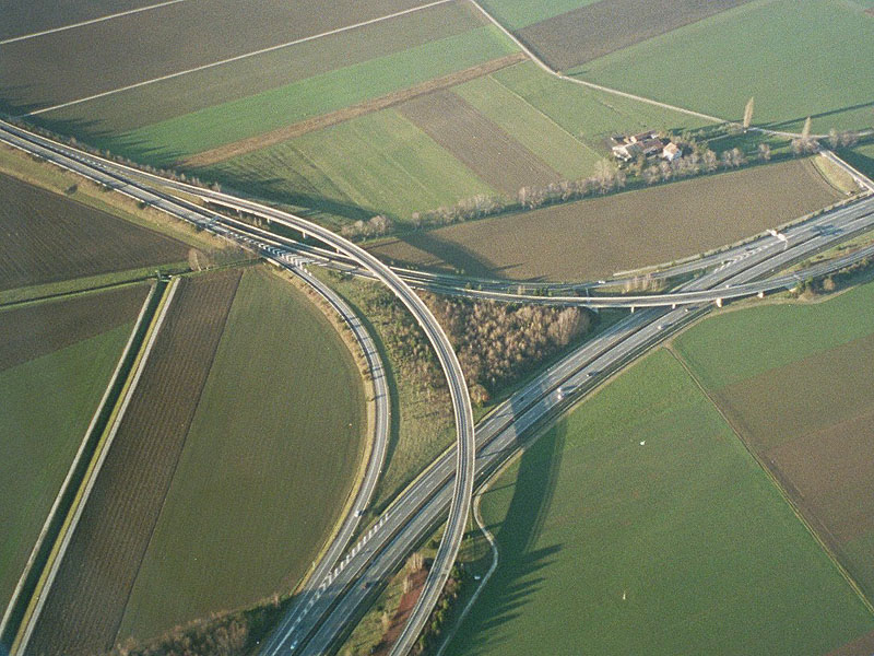
Not to belabor the point (and it should really go somewhere on the transportation board, but it does relate to downtown), but why can't MnDOT make more elegant highway junctions? It can't be rocket science. Look at this beautiful freeway junction in Switzerland:
http://archiv.ethlife.ethz.ch/images/au ... ieck-l.jpg
If policymakers made up their minds already about Hiawatha (freeway plans are dead; downgrade it to a street please) then a great candidate for a well thought through reconstruction would be where 94 and 35W branch off again heading northeast. If you take Hiawatha out of the mix, this becomes a relatively simple separation of two parallel running highways. The current design is overwrought and unnecessary.
For example, is it really necessary for Hiawatha to connect directly to 8th, 7th, 6th, and 3rd Streets? Isn't that crazy? Look at a map and see how this complicates the interchange. I think it probably made more sense before the LRT, as Hiawatha was the primary means of connecting downtown with the airport. This function has certainly declined in importance. I have not seen any studies, but I would guess that a large percentage of Airport-Downtown traffic (a huge amount of the business travellers to MSP) has switched from automobile, ie taxicab, trips to LRT.
-
mattaudio
- Stone Arch Bridge
- Posts: 7760
- Joined: June 19th, 2012, 2:04 pm
- Location: NORI: NOrth of RIchfield
Re: Minneapolis & St. Paul Fantasies and Speculations
helsinki there have been some interesting posts on streets.mn and on here about re-imagining Hiawatha as more of a street/boulevard. I agree with your ideas, and this stretch from 35W/94 to 26th Street is a remnant of that freeway plan. If we got rid of the 7th/8th ramps and adjusted the 5th/6th ramps to 94 a little, I think we could cap over this and create a "Currie Circle" that would provide a reconnection between Elliot Park, the Mill District, Cedar/Riverside, Seward, and maybe even Ventura Village.
This would be some sort of circle in the block that would otherwise exist between 7th St, 8th St, 13th Ave, and 14th Ave. 7th/8th St would connect it to DT/Elliot Park. 13th/14th Ave as a one-way pair would connect to the mill district and 35W via the replacement interchange at 3rd/4th. Minnehaha Ave could be extended northwest above the LRT to connect to the circle as well, easing the load on Cedar Ave between 94 and Washington Ave. Hiawatha would also connect into the circle from the south/southeast, and would be rebuilt to 26th as a parkway or multi-way boulevard.
The only real barrier after this would be the viaduct that carries 94 above the mess between the 11th Ave bridge and the 20th Ave bridge. Ideally the freeway could be depressed below street grade, but even if it was on a viaduct above the rest, it would still be a big improvement over what we have today.
I'll try to come up with a map to explain.
Edit: and I will move to the transportation forum.
-
MotorCity2TwinCities
- Nicollet Mall
- Posts: 112
- Joined: September 11th, 2012, 3:31 pm
- Location: Downtown
Re: Minneapolis & St. Paul Fantasies and Speculations
Fantasy - Convert the Thrivent Financial parking lot into a tower! It's that massive lot off 6th and 7th between Portland and 5th Avenue and in between Thrivent and the Hennepin County Medical Center. I can't stand that parking lot as I live right across the street from it and see it every day! It's almost like a moat separating the Metrodome, the Medical Center and STRIB buildings from the rest of downtown.
Fantasy - Have the Southwest LRT go through Hennepin in Uptown. I would love to be able to go from downtown to uptown via the LRT. The current proposal for the Southwest LRT (I believe) will have a stop by Lake Calhoun but I would much rather have one that is actually IN uptown.
Fantasy - Have street cars that go around lake Calhoun, Harriet and Isles.
Fantasy - Have more restaurants/bars along the riverfront on the downtown side, similar to those like Tuggs on the NE side of the river.
OK I'm done for now!

Re: Minneapolis & St. Paul Fantasies and Speculations
I've fantasized about converting the armory into a farmer's market like the Eastern Market in Washington DC. Maybe utilize the block to the north or the south as a "Market Park" with vendors. Further along that axis perhaps a couple of larger apartment/condo towers both north and south. (Ignore the obvious symmetry of the north towers. I just pasted the Carlyle in there to illustrate the point.) MotorCity's comment above would also work for the Thrivent lot. Here I just used the Bridgewater. I also "completed" the troubled Sexton project although I think the tower was supposed to be to the south.
This would help break that perceptual wall along 5th street made up of Thrivent, the parking ramp, County Jail and the execrable Centre Village that collectively separates Downtown East from the core.

DC's Eastern Market:


Uploaded with ImageShack.us
This would help break that perceptual wall along 5th street made up of Thrivent, the parking ramp, County Jail and the execrable Centre Village that collectively separates Downtown East from the core.

DC's Eastern Market:


Uploaded with ImageShack.us
“Wise men speak because they have something to say; fools because they have to say something.” ― Plato
Re: Minneapolis & St. Paul Fantasies and Speculations
I love this idea! It would be great to transform the block north of the armory into an urban farming park. Im envisioning the entire block as a community garden with paths winding through, benches, trees (ones that can produce fruit or edible nuts), and whatnot. Wouldn't that be sweet in the heart of downtown!I've fantasized about converting the armory into a farmer's market like the Eastern Market in Washington DC. Maybe utilize the block to the north or the south as a "Market Park" with vendors.
-
mattaudio
- Stone Arch Bridge
- Posts: 7760
- Joined: June 19th, 2012, 2:04 pm
- Location: NORI: NOrth of RIchfield
Re: Minneapolis & St. Paul Fantasies and Speculations
I love the Eastern Market... I go there every Saturday I'm in DC... there's also a vintage map collector/salesman in the parking lot who gets me a lot of sweet MN maps from long ago.
I've had similar thoughts about these lots, having worked at Thrivent for a couple years and looking out on the wasteland of surface lots to the east. Back in the Minnescraper days I had posted this idea for redevelopment that included the park on the south side of the armory, and two blocks of diagonal greenway connection south to Chicago Ave to spur new development in that area.... http://goo.gl/maps/vLP5K
There's so much potential here! Trivia: Name a music video that was filmed inside the Minneapolis armory. No peeking on Wikipedia.
Who is online
Users browsing this forum: No registered users and 72 guests